England's First Snow in Months Nears as Temperatures Drop, Met Office Warns
Unseasonable Cold and Snow Expected in the UK
Britain is bracing for its first significant snowfall since last winter as temperatures are set to drop dramatically across the country from this weekend. The UK has been experiencing unseasonably warm weather for late autumn, but a shift in wind patterns is expected to bring Arctic air into the region, increasing the likelihood of snow, especially in the north.
Storm Claudia is set to bring wet and windy conditions tomorrow, but it's the upcoming change in wind direction that will trigger the colder weather. The Met Office has warned of a "big change in our weather ahead through the next ten days," with conditions becoming "noticeably colder everywhere" by next week.
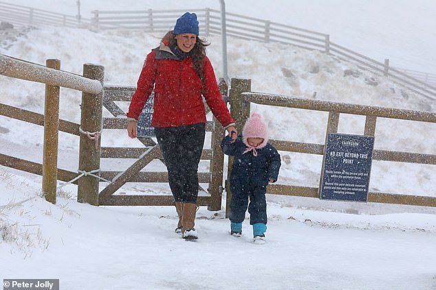
According to ITV forecaster Laura Tobin, snow is likely to begin falling in parts of Scotland today, with people already seen walking through flurries on Cairngorm Mountain in the Highlands. She mentioned that by the middle of next week, conditions could be cold enough for the entire country to experience snowflakes at times.
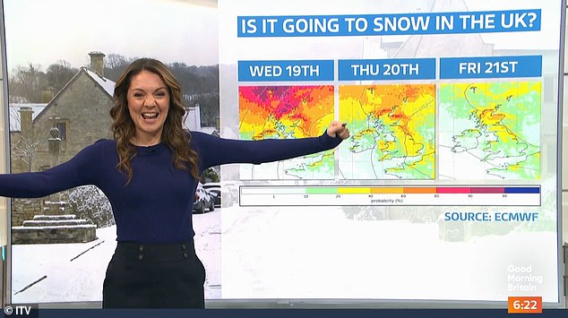
Tobin said that cold air would start to push down through Scotland and northern England from the weekend, with charts from the European Centre for Medium-Range Weather Forecasts (ECMRF) confirming the likelihood of snow from Saturday. Initially, there could be snow showers on Scottish hills, followed by more significant snowfall on Sunday in the Highlands and parts of northern England and Wales. Snow could also be seen in northern Scotland on Monday, before a pause on Tuesday.
However, Tobin emphasized that from Wednesday to Friday, there is a chance of seeing snowfall for everyone next week, with the most significant amounts expected in the north. A chance of snow is also possible for other regions as the country heads into the new week.
Before then, flooding could hit parts of the UK tomorrow, with forecasters issuing two amber warnings for rain as Storm Claudia brings heavy downpours and strong winds. While the north of the UK will be under a colder airmass by the weekend, there will be overnight frosts along with drier and brighter weather despite occasional showers.
Further south, the weekend will begin mostly cloudy and wet, with milder conditions in the far south. However, the rain will gradually ease and eventually clear to the south. The drier and colder conditions further north are expected to affect all parts of the UK by the start of next week.
The Met Office stated: "Into next week, it will initially be noticeably colder everywhere, especially in the north and east, with a brisk northerly wind accentuating the colder feel and bringing the first snow of the season for some."
Meteorologist Alex Burkill added: "There's a big change in our weather ahead through the next ten days. We're going to say goodbye to the milder and at times wetter weather we have at the moment and instead we're going to see something markedly colder and with that the risk of some snow for many places too."
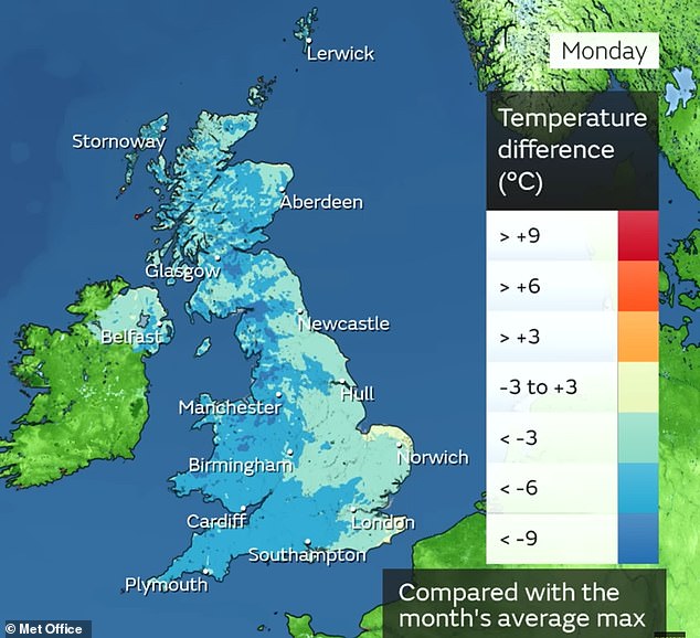
Currently, temperatures in the South are several degrees above average for the time of year, but these are expected to drop to below average through this weekend. By Monday, the Arctic air will move across the country, with temperatures forecast to be several degrees lower than average for the time of the year.
Burkill noted: "That's really going to mark quite a change to what we've become used to really through much of November when it's been so exceptionally mild." He added that a big talking point will be the chance of seeing some snow.
He continued: "Sunday into Monday, that colder air starting to cut through, greater chance of seeing some showers coming in across northern parts of Scotland in particular, a reasonable chance of seeing some sleet and snow. So affecting parts of Northern Ireland, Northern England, maybe North Wales as we go into Tuesday. But it's then through the middle and end of next week when things perhaps get a bit more interesting."
There is potential for a weather system to push its way southwards as the high drifts away towards the West. If this happens, snow could appear on the northern edge of the system and feed its way southwards, potentially leading to snow across many areas.
The last snow warning issued by the Met Office in the UK was during last winter when a yellow alert was imposed for parts of Scotland on February 18. The most recent snow warning for England was for parts of the North West on January 24.