Rain Forecast Dampens Bonfire Night Plans
Weather Forecast for Guy Fawkes Night
Families planning to celebrate Guy Fawkes Night should be prepared for challenging weather conditions, including muddy ground and the possibility of rain. According to the latest forecasts from the Met Office, most parts of the country are expected to experience light showers in the morning or early afternoon. However, there is a higher likelihood of wet weather continuing into the evening, as reported by meteorologists.
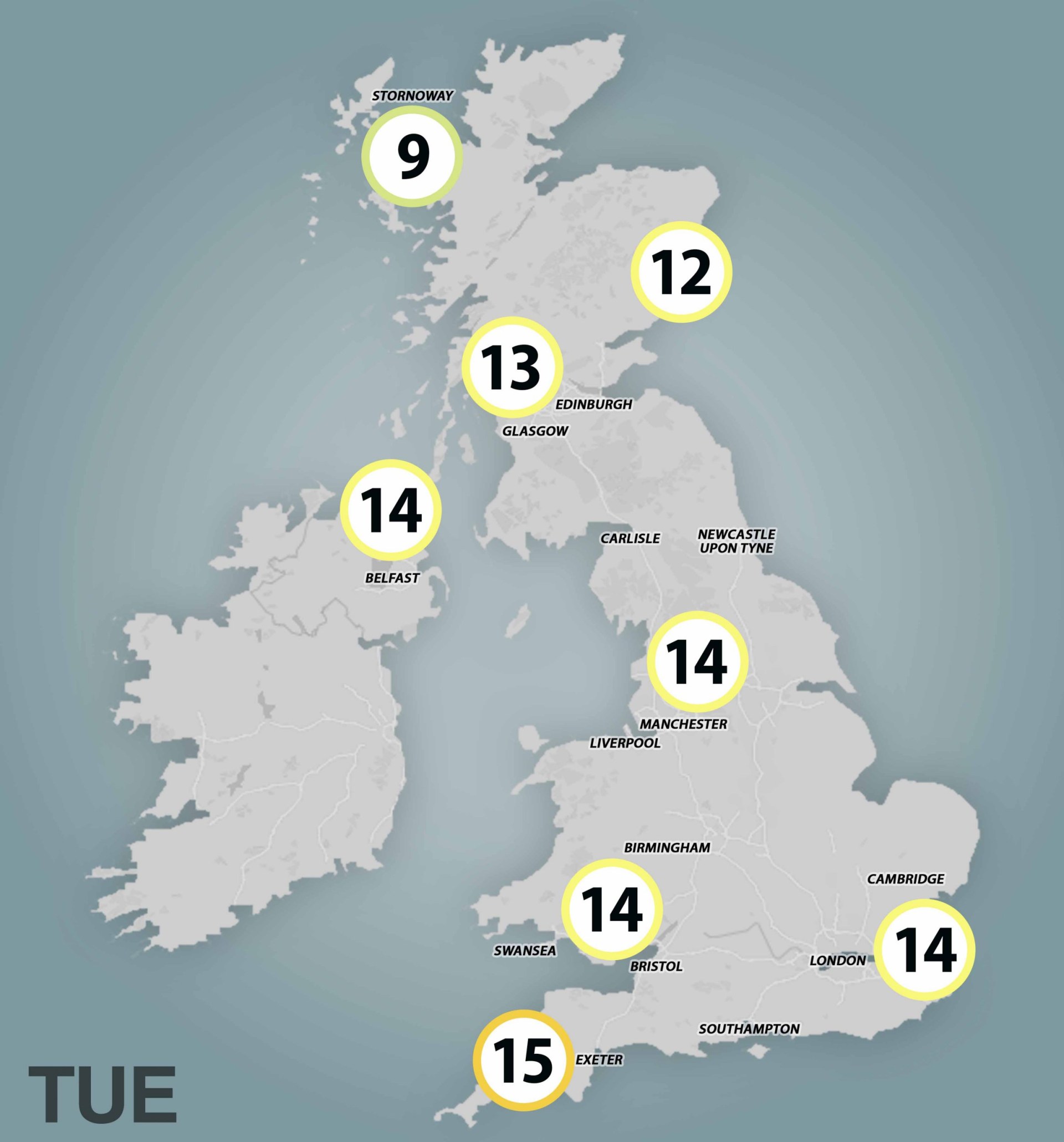
A significant weather system, consisting of fairly heavy rain from the Atlantic, is set to impact the UK on Tuesday. This rain is expected to hit Cornwall and south Wales during the early afternoon. As it moves in a northeasterly direction, it will then affect the West Midlands and much of northern England throughout the night.
Drizzles are anticipated to continue overnight across almost all regions, except for the southeast, where the weather is expected to clear up by daybreak. Despite this, further light outbursts of rain are expected throughout the day. Only Essex, Suffolk, and Cambridgeshire are likely to remain completely dry.
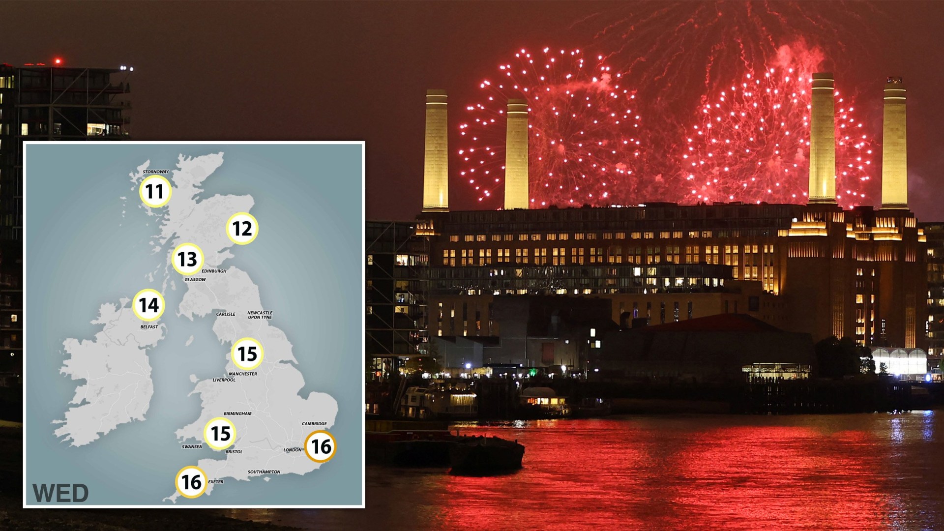
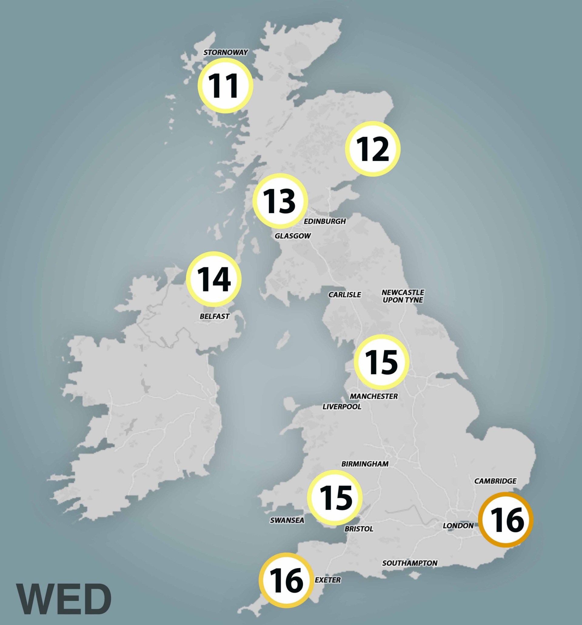
While current data suggests a drier evening for Bonfire Night, which is when fireworks events typically begin, there is still uncertainty about the weather. A spokesperson from the Met Office stated, “The most likely areas to remain dry and have clearer skies will be in central and eastern parts of England.” In contrast, areas further north and west, including Wales, southwest England, Northern Ireland, and western Scotland, are expected to have more cloud cover and a higher chance of showers.
There is some uncertainty regarding how far east these showers will extend across the UK on Wednesday evening. Therefore, it is advisable to keep an eye on the forecast in the coming days to decide whether to bring an umbrella or a coat.
Temperature Outlook
Despite the potential for rain, there is a positive aspect to the weather forecast. The evening is expected to be significantly warmer than usual. Daytime temperatures are projected to reach 16-17 degrees Celsius, with overnight temperatures remaining elevated at around 14-15°C in the south. These temperatures are unseasonably warm for Bonfire Night. However, it will be cooler further north, with lows of 6°C possible in rural areas of Scotland and Wales.
Bonfire Night temperatures typically range from 8°C to 12°C, with last year’s average hovering around 12°C. The outlook for the rest of the working week is unsettled, with forecasts indicating “often cloudy” conditions, “often windy” weather, and “longer spells of rain moving through.”
By the weekend and into the following week, forecasters anticipate further showers with a chance of heavy rain across the country. However, the western areas are expected to be the wettest. It is important to note that long-range forecasts for this period are less reliable, so the weather could change significantly.
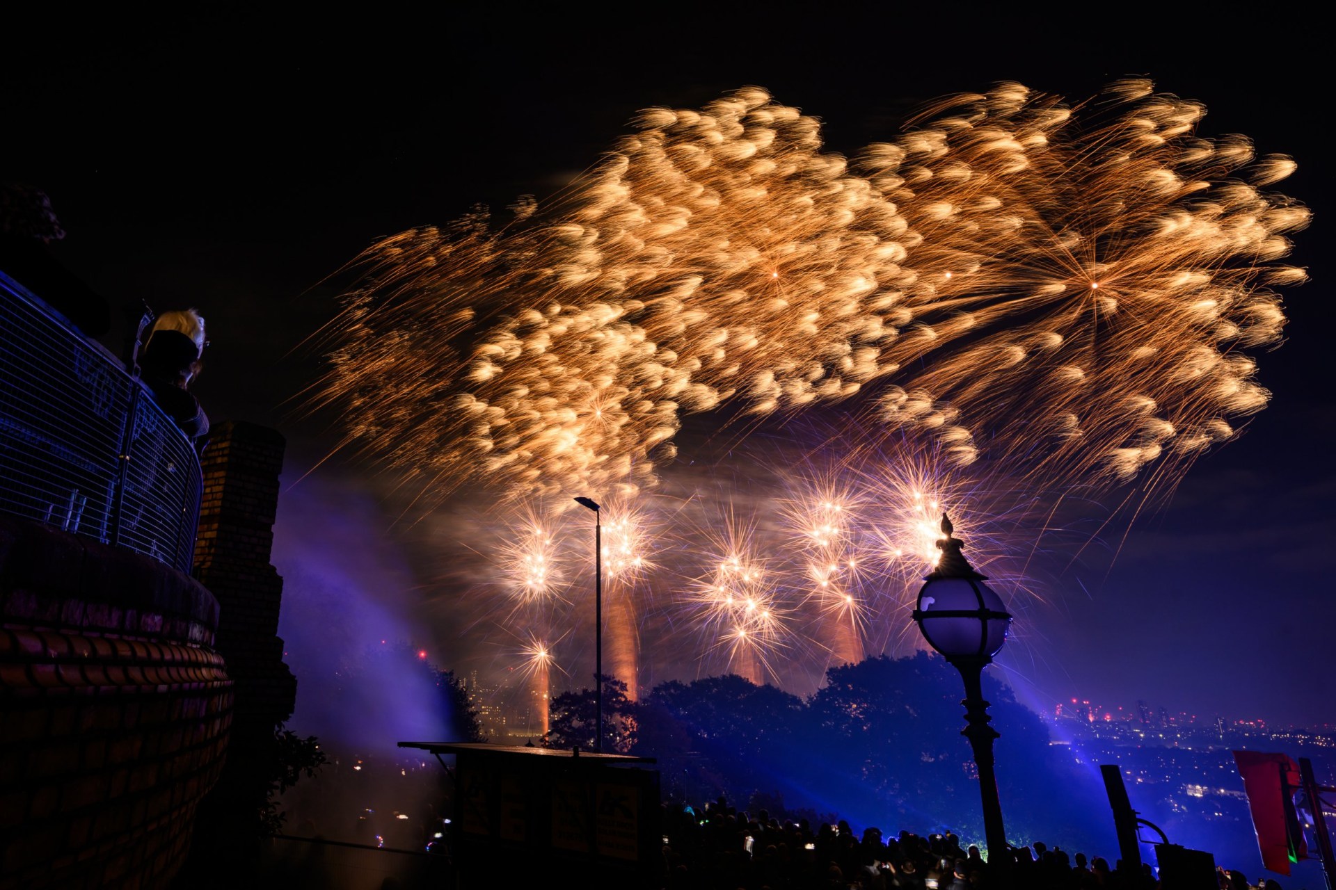
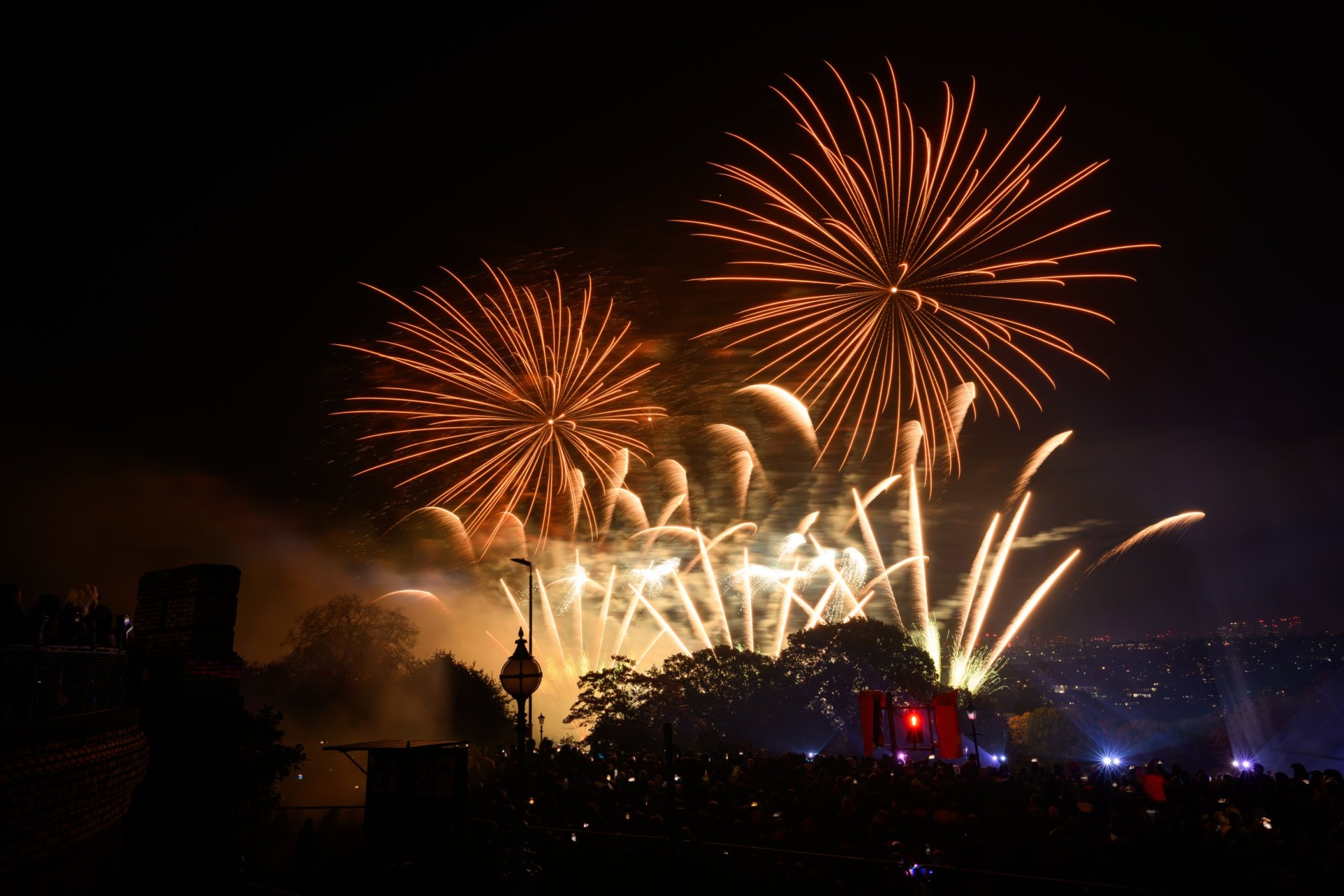
Major Bonfire Night Events in the UK
Several notable Bonfire Night events take place across the UK, drawing large crowds each year:
- Lewes Bonfire Night, East Sussex
- Glasgow Green Fireworks, Glasgow
- Ottery St Mary Tar Barrels, Devon
- Roundhay Park Fireworks, Leeds
- Clacton Pier Fireworks Display, Essex
- Wimbledon Park Fireworks, London
These events offer a vibrant celebration of tradition and community spirit, despite the unpredictable weather.
For more information on local events and updates, readers can sign up for news alerts and stay informed through various platforms. If you have any questions or comments, feel free to reach out to the news team via email. Stay updated with the latest stories by visiting the news page regularly.