UK Weather Map Shows Rain Drenching Brits in Hours
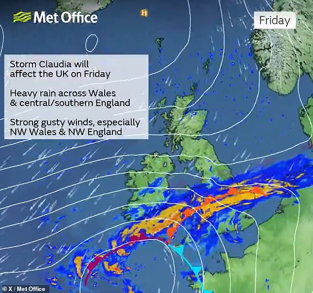
Storm Claudia Brings Heavy Rain and Strong Winds to the UK
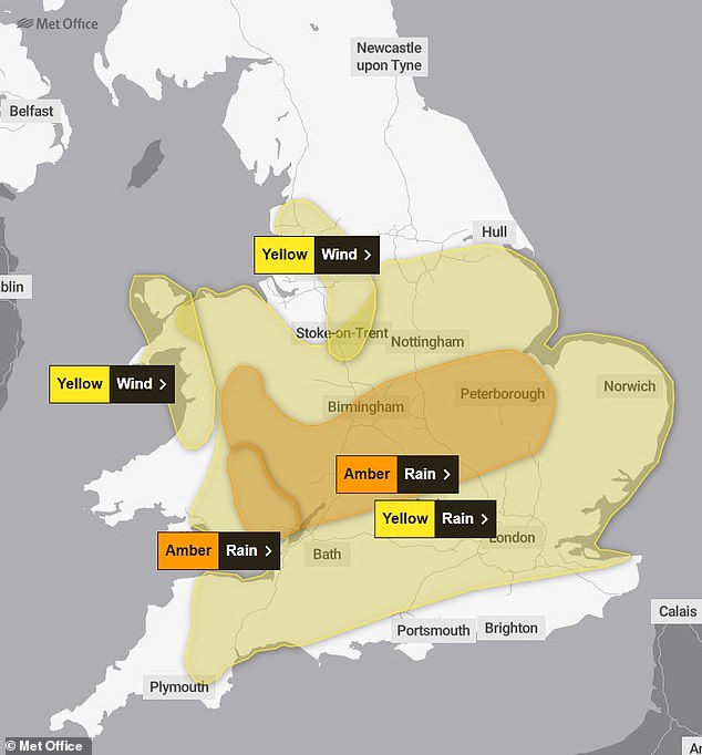
A new weather map has revealed that Storm Claudia is set to hit the UK with up to six inches of rain and wind gusts reaching 70mph within a short period. The Met Office has issued two 'danger to life' amber rain warnings for parts of central England and South Wales, which will be in effect from 12pm to midnight today. Additionally, a wider yellow rain warning is active across most of southern England and the Midlands, running from 6am tomorrow until 6am on Saturday.
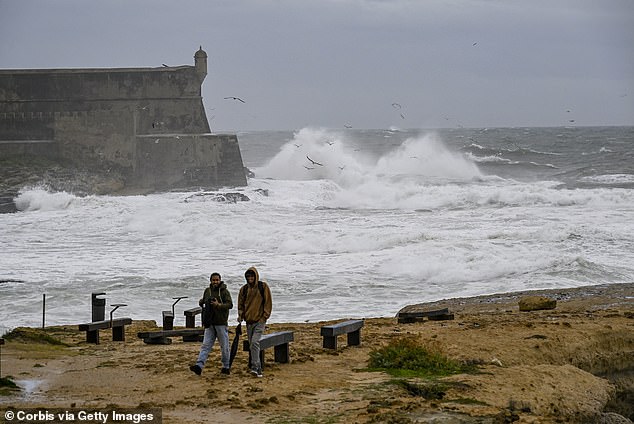
Storm Claudia was named in Spain, where it is currently affecting western Iberia and the Canary Islands. The storm is bringing prolonged heavy rain and strong easterly winds to the UK. A map released by the Met Office shows the areas where heavy rain is expected to sweep across central and southern England.
Unlike previous storms, Claudia lacks a 'distinctive swirl' and is moving slowly, which could lead to prolonged periods of heavy rain. The forecast suggests a mild but wet start to tomorrow across most of England and Wales, while Northern Ireland and Scotland are expected to have a drier morning.
South Wales is anticipated to receive the most rainfall, with 50mm to 75mm (3in) of rain widely expected in the amber warning area, and 100mm (4in) to 150mm (6in) on some higher ground. The area of central England under the amber warning is expected to see 40mm (1.6in) to 60mm (2.4in) of rain, with some parts of the East Midlands, western England, and higher ground in Wales possibly receiving around 80mm (3.1in).
Forecasters warn that travel disruptions could be worsened by strong easterly winds, with gusts of 50 to 60mph expected during the afternoon and evening. Up to 70mph is also possible over exposed hilltops and coastal areas, along with thunderstorms later tomorrow afternoon and evening.
The amber warning for central England states that fast-flowing or deep floodwater is likely, posing a danger to life. It also warns of homes and businesses being flooded, causing damage to some buildings. The warning highlights difficult driving conditions, road closures, and potential delays and cancellations to train and bus services. Power cuts and loss of other essential services to some homes and businesses are also possible.
The amber warning for Wales includes similar concerns, with additional warnings about the possibility of losing power and other essential services such as gas, water, or mobile phone services.
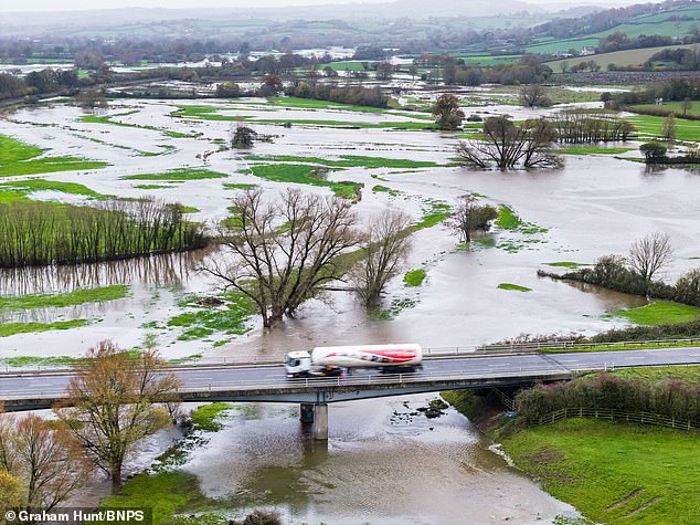
The Environment Agency has warned that local flooding is possible from rivers and surface water. As of now, there are 20 flood warnings and 35 flood alerts across England. Natural Resources Wales has issued eight flood alerts, while the Scottish Environment Protection Agency has activated two flood warnings and seven flood alerts.
Despite these recent weather events, the Environment Agency has warned that England will experience widespread drought after the dry spring and summer of 2025. Drought is declared only when water levels are fully replenished, and England has seen below-average rainfall for eight out of 10 months so far this year, with only January and September registering above average rain.
The country has received only 83% of the average rainfall for January to October, and suffered the driest spring in 132 years, along with the hottest summer on record. Despite recent rainfall, the situation remains 'precarious', according to the Environment Agency.
If the winter is drier than normal, much or all of the country could be in drought by next spring, leading to hosepipe bans, effects on crops and wildlife, and an increased risk of wildfires as the summer progresses. Dry conditions also raise the risk of flash flooding when rain does come, as dry soils struggle to absorb heavy downpours, leading to runoff and floodwaters.
Environment Agency director of water Helen Wakeham said, "There will be a drought next year unless we get sustained rainfall through the winter. The severity of that drought will depend both on the weather and the actions we take over winter following this very dry year."
She urged the public to continue using water efficiently this winter, even if it is raining outside. "Our wildlife, our rivers, and our public water supplies depend on it."
If England receives an average amount of rainfall over the winter, all areas of the country will be in a normal or recovering condition by March 2026, with the exception of parts of Cambridgeshire and Bedfordshire, which will still be in prolonged dry conditions.
Will Lang, chief meteorologist at the Met Office, said, "While it's not possible to definitively forecast weather for the next three months, the chances of a dry period are higher than normal. A more average three-month period for rainfall is still the most likely scenario."
Water minister Emma Hardy emphasized that the government will continue to work with the National Drought Group and water companies to maintain supplies for communities across the country. She highlighted the need for long-term water resilience, including building nine new reservoirs and investing in new pipes to reduce leakage.
As the UK braces for the impacts of Storm Claudia, the question remains: Will the final days of summer bring England and Wales under torrential downpours, or will the rain provide a much-needed reprieve from the ongoing drought?